An interview with fire meteorologist Professor Craig Clements
April 12th 2021. Melissa Sterry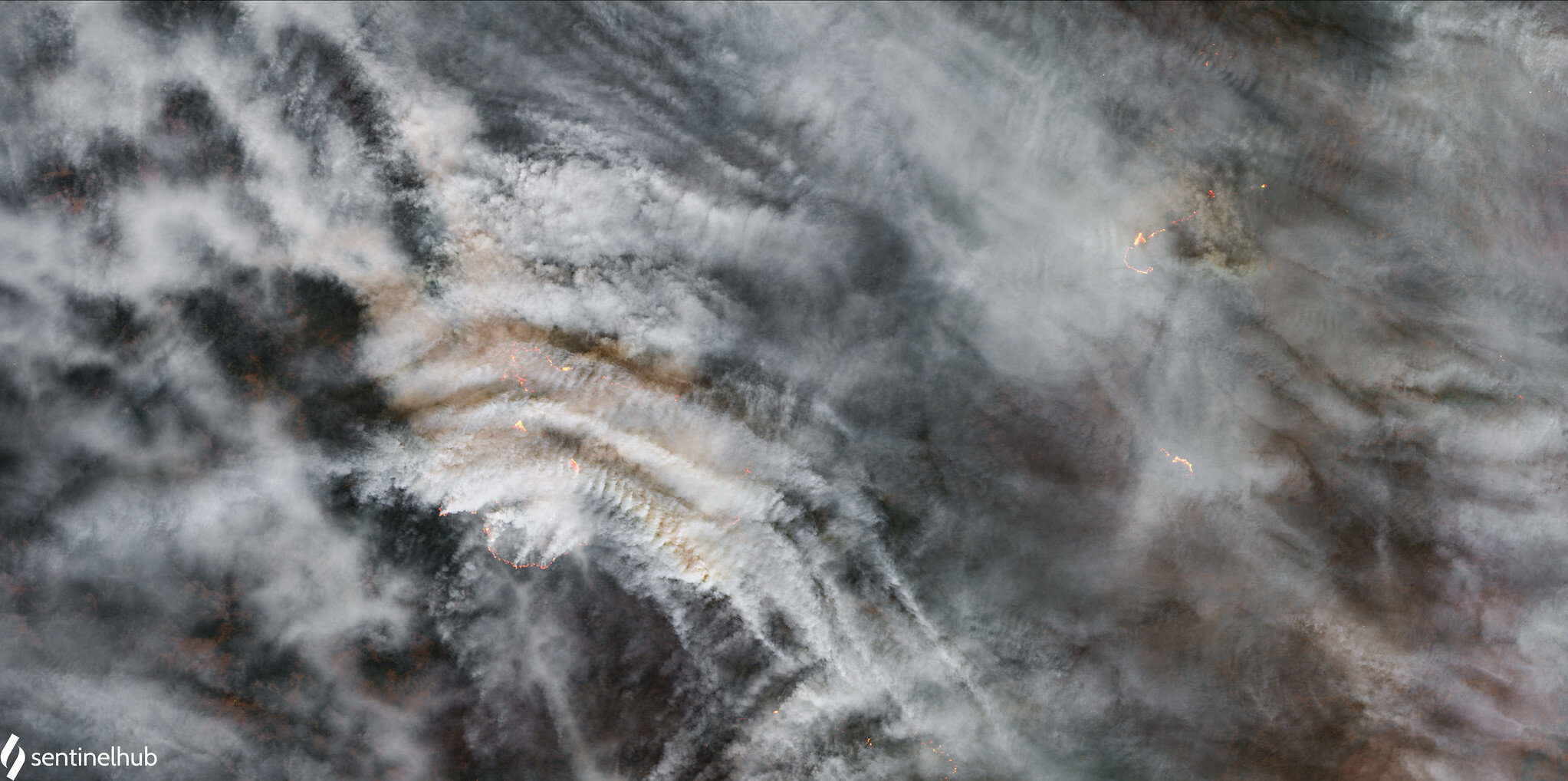
A professor and director at the Fire Weather Research Laboratory at San José University, meteorologist Dr. Craig Clements’ research makes the previously unseen inner workings of wildfires visible. Here he sheds light on how the likes of Doppler lidar are helping us to understand fire behaviour and why…
MS: From your doctorate onwards, you have worked with leading-edge technologies for measuring, monitoring, and modelling various aspects of wildland fires. Describe some of these technologies and the ways in which they have enabled you to see that which was invisible in the past.
CC: Higher resolution forecast models and Doppler lidar and radar observations have shed light on a number of mechanisms that in the past, were only hypothesized. For example, we now know that smoke shading from the plume, can impact the surface conditions at the fire front. This can really be a major feedback mechanism on fire spread, potentially causing the fire spread rate to decrease.
MS: Thinking to recent breakthroughs in fire meteorology and atmospheric science more generally, what do you consider to be the most significant advances in our understanding of how and why wildland fires behave as they do and why?
CC: At a time when fires appear to be getting larger and more severe, we are monitoring their characteristics better, particularly with new remote sensing technologies. I believe high spatial resolution satellites are, and will in the future, provide the most significant advances in our understanding of fire behaviour. Additionally, new infrared camera systems that can be mounted on aircraft can also allow us to better observe the fire environment and fire behaviour.
MS: As a fire scientist of whom some of the research activities are undertaken within the immediate vicinity of wildfires, have you directly observed any changes in their typical behaviour throughout your career?
CC: I have not seen it personally, so not really. But it is happening. Our team goes through firefighter training each season, so we can be qualified to be on the fireline. This provides my team with knowledge and understanding of safety protocols needed in this environment. It’s much different than say, storm chasing, because we are often in an area that is closed to the public and where many first responders are engaging in fire suppression operations. So having that knowledge is critical to keeping safe while collecting data on fire behaviour. It is apparent, that when we deploy our assets to the fire line, the fires are very destructive and some fire seasons are worse than others, so one year we may be on a fire that’s fairly “typical” while other years, the fires are much more destructive. We really try to stay out of those areas because my team are students and not professional firefighters. The good thing about the technologies we are using is that we can scan a fire from 2-4 km away, so we are usually in a very safe location.
MS: Working with, among other equipment, a truck-mounted Doppler lidar, describe some of the ways in which the data that you and your team capture can help emergency crews working to mitigate risks to both people and property.
CC: We provide atmospheric conditions such as wind profiles to the incident meteorologists. That information can help fire behaviour analysts understand where a fire may move next and at what rate.
MS: Which current and emerging imaging, radar, and related technologies do you think might have the biggest impact to the field of fire meteorology and why?
CC: I think new networks of high-resolution Doppler radars are the key to observing the fine-scale observations of wildfire plumes and fire behaviour. Radars don’t have to be large and / or mobile. The technology is getting smaller (in terms of size and required power), so these systems can be deployed on power transmission towers, buildings, etc. These systems would be the next-generation of technology that would be of high impact for our field.
MS: Casting your thoughts to artificial intelligence, to machine learning more generally, and to big data, how do you think advancements in these fields may shape your research and that of your peers within a decade?
CC: They are already ubiquitous, such as in a lot of forecast systems, including those we use.
MS: Thinking beyond the fire sciences community and to the public at large, what role do you think citizen science has in expanding our understanding of wildland fire behaviour?
CC: It’s very important. Think about Twitter during fire season - so many photos and movies from citizens in near real-time showing fire behaviour. It’s really helped the fire science community. Though already being done, I believe that more information will be mined from photos and online posts in the years ahead.
MS: Fire seasons already never-ending in some regions, and the bandwidth of possible climate trajectories suggesting that fire weather will become more extreme as the century unfolds, what steps do you think need to be taken to better enable society to contend with the challenges ahead?
CC: Big question. Not sure how to answer and out of my wheelhouse of expertise. But, for communities in the western US, people need to think about fire weather as extreme weather, like those in regions where tornadoes and hurricanes are a threat. It’s getting worse, so we need better public information for communities to be aware of dangers that may affect them.
MS: Which 3-5 books do you recommend they interested to learn more about fire weather and fire science more generally read and why?
CC: Not many available. I’m working on a textbook now, but I think the Extreme Fire Behaviour document that I co-authored with many others is the best document available. It’s free and online for download.
MS: The year is 2030. What’s the worst-case western US wildland fire scenario you visualise?
CC: Maybe like 2020? But it is hard to know. Perhaps, given a few drought years in a row, we could expect some apocalyptic scenarios? Then again, …
MS: The year is 2030. What’s the best-case western US wildland fire scenario you visualise?
CC: A year like 2019, but that’s unlikely if extended drought continues, which could take things off the charts. Uncertain times and all we can do is best-guess.
Read more about Craig’s research here.
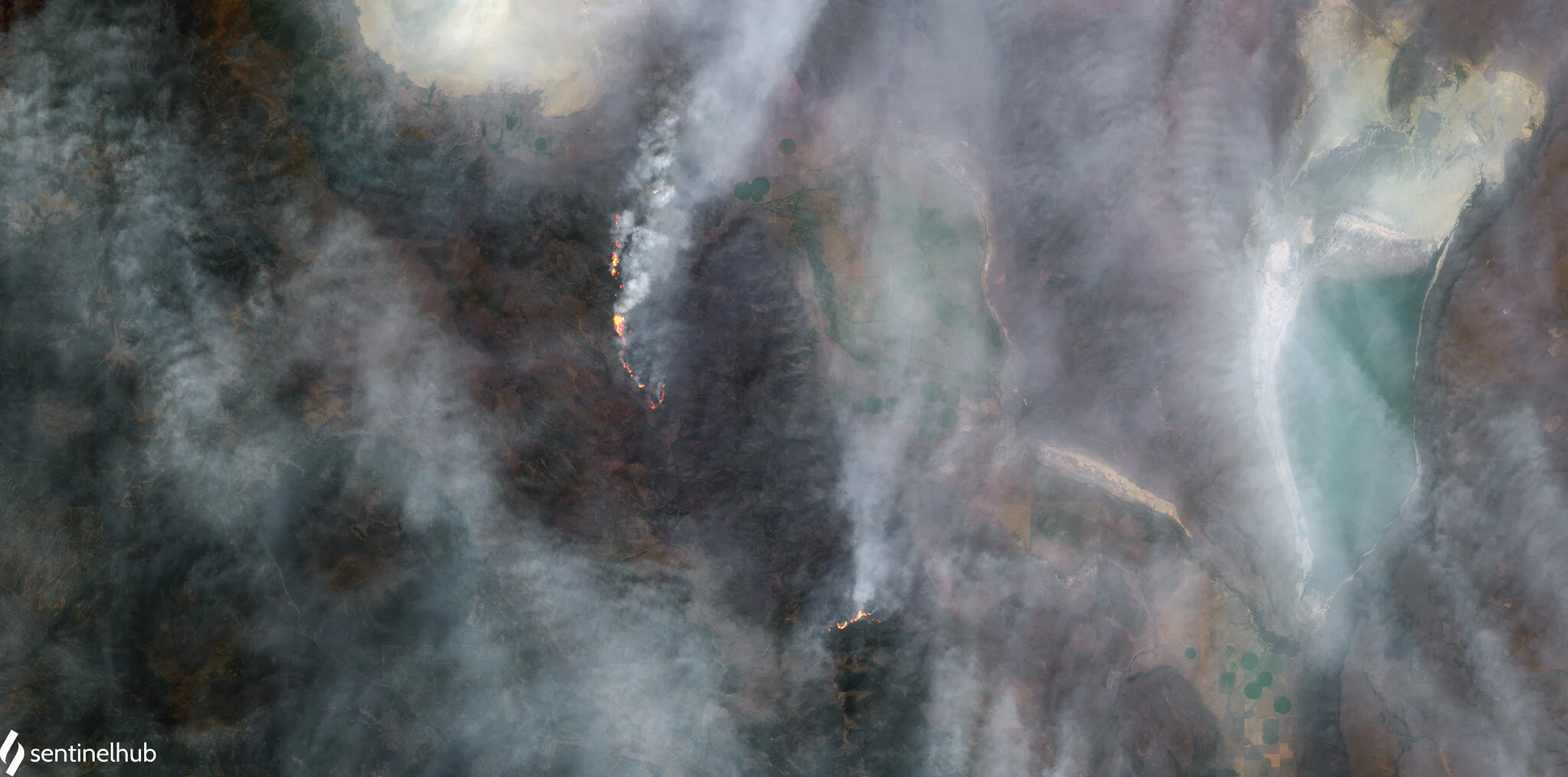
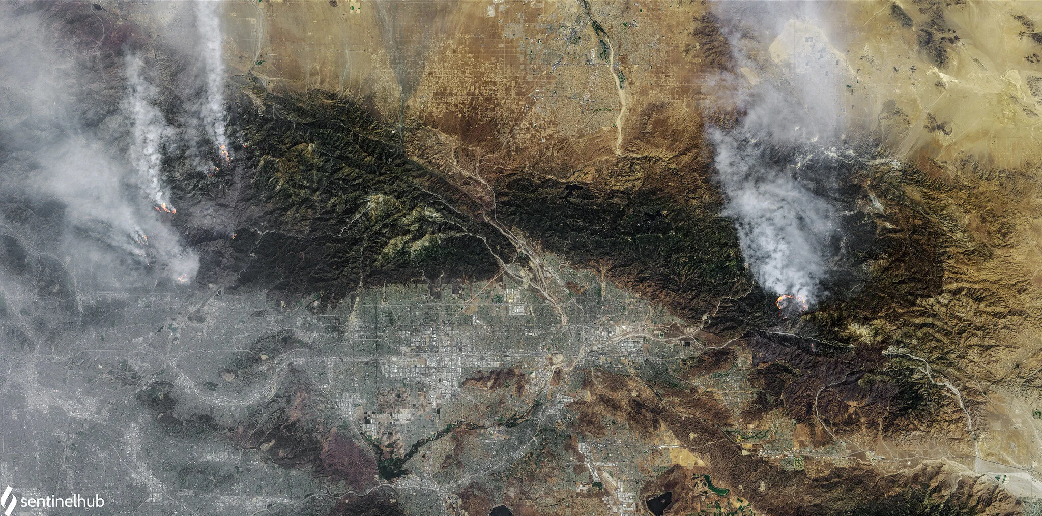
Images : [Top] Parts of the August Complex and Zogg Fire, California, taken on September 29th 2020 [Middle] Brattain Fire, Fremont National Forest, Oregon, taken on September 16th 2020 [Bottom] Bobcat Fire, El Dorado Fire, and Apple Fire, taken on September 15th 2020. Each image contains Copernicus Sentinel data processed by Pierre Markuse.