Panarchistic Architecture :: Chapter #4 [4.4]
Citation: Sterry, M. L., (2018) Panarchistic Architecture: Building Wildland-Urban Interface Resilience to Wildfire through Design Thinking, Practice and Building Codes Modelled on Ecological Systems Theory. PhD Thesis, Advanced Virtual and Technological Architecture Research [AVATAR] group, University of Greenwich, London.
Case Studies :: Part I Fire Regimes
4.4 Overview
Having discussed wildfire in its planetary context, and the qualitative differentials that are manifest in the low, mixed, and high-severity fire regimes of the western U.S., in this section the lens thereof is applied to fire behaviour and ecologies at the landscape scale, using studies of three of the largest fire complexes of the past three decades. The following constitutes the first of five parts, which interspersed across chapters 4, 6, and 7, informs future WUI scenarios through a systemic interrogation of past events.
4.4.1 Case Study #1: 1988 Yellowstone Fire Complex
“The very heavens seemed afire”. Henry, 2015.
Established in 1872 to preserve the integrity of its geysers, hot springs, and thermal pools, thereon, in 1883 its wildlife, Yellowstone National Park [YNP] is one of the world’s most well-known wildlands. Biome-types within its boundaries include sagebrush grasslands and mixed coniferous forests. While historically home to Native Americans [13ty], who used fire as an integrated part of their landscape management, in the late 1870s the latter were moved to reservations, and with them, their fire culture. In their absence, while careless campers sparked numerous fires in the early years of the park’s existence, ignorant of wildfire’s role in maintaining the integrity of the Greater Yellowstone Ecosystem [GYE], the park’s caretakers, who prior to the creation of the National Park Service in 1916 were the U.S. Cavalry, took various measures to fight fires, a policy that continued until 1968.
As the 20th century advanced, and with it understanding of the role of fire in ecological systems, the park’s policy integrated fire into its management. By 1972, a ‘let it burn’ approach was applied to 15% of the park, but by 1976 it extended across most of its acreage (Henry, 2015). The park’s mixed conifer forests’ historic fire regime mixed to high-severity, therein aligned to long fire cycles of 200-400yrs (Millspaugh et al, 2004), the impact of the policy transition arrived not with immediacy, but with a shift in meteorological conditions. In the period 1972 – 1987 a mere 36,000 acres burned (Ibid). But, the ‘mercury fast rising’, the sum thereof was to be but a fraction of what was imminently to come.
In the mid-1980s “an abrupt and sustained regional increase” in wildfire activity occurred in the forests of the western U.S., and in particular at latitudes 42°-50°, the foci thereof in the northern U.S. Rockies (Westerling, 2016). Rising regional temperatures and a shift in precipitation patterns, including lower-than-average rainfall, and earlier springtime snowmelt was manifesting wildfire scenarios that the palaeological record evidenced to have occurred repeatedly throughout history (Ibid). Regionally, tree mortality was fast rising, as low precipitation reduced the capacity for adaptive heat responses including evapotranspiration, and for pest resilience. Had employees of the National Park Service the capacity to see the increase in wildfire activity as was to unfold in the coming four decades in the regions of the Northern Rockies, Northwest, Sierra Nevada, Southwest, and Southern Rockies, they may well have needed a second look to check the statistics were correct. Between 1983–1992, wildfire activity was to increase an average of +259% across the regions, rising to +361% between 1993-2002, thereon 556% between 2003-2012 (Ibid), there figure thereof still rising. However, large though those figures are, they are dwarfed by the increases to burned area, which average +640% between 1983-1992, +991% from 1993-2002, and +1271% in the period 2003-2012. Whereas, in the wildland urban interface, human causation is the predominant ignition source, the wildland and intermix areas above, lightning activity, more specifically, an increase thereof, is the primary source (Ibid).
In the summer of 1988, YNP was to become the archetypal case study in understanding how climatic, and broader environmental transitions impact upon fire regimes, and in turn, on the communities, human and otherwise, as are reliant thereupon. A mountain pine beetle [Dendroctonus ponderosae] infestation, in concert with drought had produced tree mortalities in thousands (Turner et al, 1999). Compounding the issue, the park’s resident fire-evaders, its extensive Lodgepole pine populous, they being a fire-adapted species which have evolved to repopulate upon its passing, were largely nearing their end of life, therein succumbing to the ultimate outcome of ‘old age’. Additionally, the winters of 1986 – 1987 and 1987 – 1988 brought unusually low precipitation (Wallace, 2004). Hence, while summer 1987 and spring 1988 had higher than average precipitation, at just 2-3%, the fuel-moisture levels were low (Ibid) yet ground fuels, including fire-carrying grasses, abundant. The pyrotechnical stage was set, and while the ‘fire gods’ [civic scientific advisors], as park guide, researcher, and author Jeff Henry dubbed them, saw not the firestorm coming, several YNP rangers did, one commenting in the spring of 1988 that, “smoke’s gonna be rollin” soon (Henry, 2015).
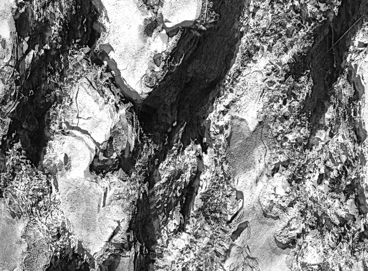
When, above average temperatures [+8.6°C in June, +2.7°C in July] (Ibid), and dry thunderstorms arrived in June 1988, YNP’s fire triangle was completed. The first fire in the Yellowstone Fires complex, the Storm Creek Fire, was ignited on June 14th by lightening, as were the several fires that immediately followed, including the Fan, Shoshone, and Red. Both human actions [accident] and infrastructure [power-lines] caused additional fires within the complex, including the North Fork Fire, which grew to over 500,000 acres. As a complex, the fires reflect the extent to which weather, topography, and fuel state, amongst other factors, shape fire behaviour, including spread rate, intensity, and severity [Fig. 34]. Spread rates varied considerably throughout the 3-month firestorm, accelerating and decelerating as wind speeds increased or decreased, terrain rose and fell, and fuel density and type shifted as the fire spread across the GYE forest mosaic. Consequently, the fire’s ecological legacy was similarly heterogeneous.
At its peak, the fire complex rapidly engulfed large tracts of forest, its forward motion propelled by both atmospheric conditions in combination with its internal dynamics [i.e. radiative heating, spotting, etc]. Greater than the orders of fire-spread magnitude observed within living memory, the fires were indicative of fire behaviours that have become common in subsequent decades. On September 7th those fighting the fires noted flame lengths of 30-60m above the canopy, together with fire tornados, extensive crowing runs, and spotting (Henry, 2015). Two days later the fires were so intense they burned through 228,137 acres, thereon 100,000 the following day (Ibid). However, such is the heterogeneity of GYE’s forest landscape as for all variants of fire-severity [severe, moderate, light, and unburned] to have featured in the fire- footprint (Anderson and Romme, 1991).
Post-fire, [Fig. 35] true to serotinous form, the park’s Lodgepole pine population seeded abundantly, the populations thereof relative to the pre-fire stand densities (Anderson et al, 2004). Where fire-severity was acute [i.e. crown fires, which destroyed and estimated 80-88% of seedlings, despite an estimated 50% being serotinous] seeds dispersed from adjacent plots that had been subjected to moderate fire-severity, where trees had burned, and cones opened, but seed mortality was low (Ibid). Evidencing that severe fires are advantageous to species that have adaptations thereto, studies of post-fire plots of Lodgepole seedlings found that both height and diameter growth rates were higher in the aftermath of canopy fires than moderate fires in 5/6 and 4/6 cases respectively, and that, over-time, the effects “become exaggerated” (Ibid, p.81).
Together with the fire’s heterogeneity, pre-existing landscape features, including soil texture and type, slope gradient and aspect, microclimate, and pre-fire plant communities resulted in varied re-vegetation rates (Meyer, 2004) and assemblies throughout the park’s post-fire landscape. Shifts in sedimentation transportation and geomorphology, including soil erosion, led to wide-scale debris flows and flash floods, and saturation-induced slope failures upon the arrival of precipitous storm (Meyer, 2004).
While GYE’s Sagebrush grasslands are not the foci of this case study, analysis of the fire’s impacts whereupon it spread into this biome-type evidence a similar ecological response to that of the Mount St. Helens eruption of May 18th 1980. For example, both events stimulated Lupine [Lupinus Lepidus] reproduction, in the former instance upon the passing of the fires (Ibid), in the latter, upon the disturbance caused by the eruption’s lateral blasts, pyroclastic flows, resulting fires, and soil displacement (Bishop et al, 2005). Thus, in this, and other instances [i.e. species within the Poaceae family] functional traits that evolved to provide resilience against fire, likewise provide resilience against one or more other genres of environmental disturbance.
Both within GYE’s coniferous forests, and its grasslands, the 1988 fires improved foraging quality, therein befitted wide-ranging members of the ecosystems’ faunal communities, including insets to herbivores (Singer et al, 2004), therein illustrating merit in the fire culture of the park’s original human inhabitants, Native Americans. Furthermore, the post-fire landscape provided ample feeding and nesting habitat for birds and small mammals, such as the Three-toed woodpecker [Picoides arcticus and P.tridactylus], of which populations were boosted by the fires (Tinker and Knight, 2004). Likewise, the park’s carnivorous megafauna, including its Grizzly Bears [Ursus arctos ssp.] benefitted from the fires, for, as had early humans on the African savannah, they foraged the equivalent of a ready-cooked picnic: the carcasses the fires left behind (Green et al, 1997).
The GYE’s past, as evidenced in numerous paleobotanical studies of this past 3 decades, makes clear that its fire regimes shift in concert with changing climate, thus fire frequencies, intensities, and severities are not constant in space and time, nor species populations and distributions. Hence, the ecosystem, or rather nonequilibrium system of spatially and temporally complex ecosystems, illustrates the evolutionary nature of landscapes, both structurally and behaviourally. We can see this visually in pre and post-fire satellite images take of GYE between 1987 - 2010 [Fig. 36].
In the context of the wildland urban interface, and of the convergence of human and non-human phenomenon more generally, the history of the GYE, and in particular its fire history, puts paid to the contrived notion that humanity can exert control over Earth Systems we have yet to fully understand. When, both theoretical and computer modelling, together with the palaeological record, suggest that regionally, nationally, and globally, wildfire activity across several biome variants is set to increase, and no less so than in those of the YNP, this case study serves to illuminate some of the challenges - practical, philosophical and psychological - as may be inherent therein.
Yellowstone Fire Complex 1998
Fire Regime Data [Tab.1]
Timing
Ignition date: June 14th 1988*
Declared a major disaster: N/A**
Fires extinguished: Nov 18th, largely contained Sept 10-11th***.
* While several fires had broken out earlier in the month, all had extinguished. The Storm Creek Fire, which ignited on June 14th, marked the start of the fire complex that was to spread to 36% of the park.
** Although representatives of the President’s office attended the scene, and Congress facilitated fire-fighting and recovery funds, the event was not attributed major disaster status.
*** The fires were largely contained by the arrival of the season’s first snowfall.
Biome
Type: Mixed Conifer Forest [across the areas the fires burned].
Historic regime type: Mixed to High-severity [>1890 fire-cycle 20-50yrs] [1].
Fire resilience variant: Primarily Evaders* [Lodgepole pines dominant]
Trajectory
Most model simulations suggest that, based on the bandwidth of climate trajectories, the park’s near-future fire regime will be analogous to that of the early Holocene, 6000tya [1], when fire frequency was considerably greater than during the first several decades of the 20th century.
Fuel-state
Exceptionally dry falls, juxtaposed against unusually precipitous summers [2,3,4] (reaching 200-300% above average) in the immediately preceding years, which contributed to tree mortality, while accelerating growth of forest floor fuels. In 1988, precipitation of 155- 181% above average during April/May was followed by drought from June – August [2]. As above, tree mortality increased by a beetle infestation, and by many Lodgepole pines reaching end of life term.
Land-use type
Wildlands; Wildland Intermix.
Acres burned
Total acres burned [within YNP]: 793,000> acres [approx. 36% of acreage] [5]. Areas: Yellowstone National Park, Wyoming.
Fires in complex
Fires attributed to the complex included* Storm Creek; Shoshone; Fan; Red; Lava: Mist; Mink; Falls; Raven; Clover**; Lovely; Wolf Lake; North Fork [at 500,000> acres the largest fire in the complex]; Factory; Ridge; Fern; Sour; Emerald; Hellroaring; Snake; Huck [1].
*Found significant variances in estimates of acreage burned by individual fires within the complex, which has been attributed to the absence of standardised boundary demarcation for fires within the complex, some of which merged to form larger fires, and for which post-fire burn scar estimates were largely calculated in the absence of satellite technologies. Hence, acreage burned by individual fires within the complex has been left unspecified.
** The above lists the individual fires, many of which converged to form sub-complexes, such as the Clover-Mist Fire, which incorporated the Clover, Lovely, Raven, Shallow, Fern, and Sour Fires, burning approx. 400,000 acres in all.
Causations
Known causations include 42x Lightning [many of which quickly burned themselves out]; 9x Human-caused [inc. 1x dis-guarded cigarette] 6; 1x Power lines; and Fire spotting.
Sources: [1] Millspaugh et al (2004) [2] Zuckert (1989) [3] Turner, Romme and Gardner (1999 [4]. Henry (2015) [5] NASA [Earth Observatory] (2016) [6] National Park Service (2016).
4.4.2 Case Study #2: 2003 Southern California Fire Complex
“There are historical accounts of even larger fire events”. Keeley et al, 2004.
The southern Californian wildfires of October 2003 [Fig. 33] may be considered as emblematic of a transition from the regional fire regimes of the Holocene to those of the Anthropocene. Historically, the areas through which the fires passed, of which 95% were chaparral shrublands, the remainder mixed conifer forests, had sustained frequent, but generally low-intensity surface fires (Keeley et al, 2004). However, as in the case of YNP, several decades of fire exclusion and suppression had caused changes in both biome-type’s biomass density and composition, thus the wildfire frequencies, intensities, and severities, as would ultimately result therefrom. In the mixed conifer forests the biomass build-up facilitated the potential for a transition from surface fires to ladder-fuel-facilitated stand-replacing crown fires. Likewise, though their comparatively lower fuel loads rendered the chaparral shrublands a little more resilient to fire-regime change, fire exclusion and suppression had paced the way for fire-intensities that exceeded they of the regime (Lentile et al, 2007).
However, such was severity of the drought that preceded the October 2003 wildfires as to suggest that, whether young or old stands, even indigenous species of the lowest density woodlands and shrublands would have been severely moisture-stressed, therein, in at least some instances, not merely tinder-ready, but less physiologically able to withstand fire. The possibility thereof is supported by studies that found that, in some chaparral areas, vegetative-thinning, including removal of dead biomass, has not the capacity to reduce fire frequencies (Conrad and Weise, 1998; Keeley and Fotheringham, 2001; Moritz, 2003).
The timing of the southern California 2003 fires was atypical for the region, coinciding with the onset of the Santa Ana autumnal winds, of which the speeds [50- 60 m/p/h] enable rapid fire spread (Keeley et al, 2004) [Fig. 37]. Therein, true to regional fire form, weather played a predominant role in the spatiotemporal curation of the fires. Although, since reliable records began in the early 1930s, the fires were, then, unprecedented in their scale, they were well within the historical range as preceded the onset of suppression policies, as evidenced by a fire complex of some 3x their size that burned through Orange Country in late September 1889 (Ibid).
Topographically, the landscapes through which the 2003 fires spread include both rolling and steep hills and mountainous slopes, this being a factor that in combination with fire-severity, intensity, and pre-existing species communities, contributed to post-fire recovery patterns. In chaparral landscapes, “within the first few days or weeks”, post-fire root sprouting, seeding, and germination occurred (Lentile et al, 2007, p.96). However, unlike YNP’s post-1988-fire recovery, non-native species were abundant in some areas (Ibid), which in the instance of grasses would increase the probability of shortening the fire-cycle. Nonetheless, within a few seasons, chaparral shrubs and forbs had repopulated many sites to near pre-2003 biomass levels, therein restocked fire’s fuel supply.
Southern California’s mixed conifer forests fared less well, as is exemplified by the post-fire recovery of Cuyamaca Rancho State Park. Barely burned since 1911, the park’s forest-understory was abundant in shade-tolerant species of which the population would have been lower but for the relative absence of fire due to suppression policies. Hence, when the fires finally did arrive intense crowd fires ensued, and with them a tree mortality rate of 98% of mature conifers (Brennan, 2013). Furthermore, fire intensity was so great that, in contrast to the mosaic the historical fire regime had produced, the 2003 fires, or more specifically, the Cedar Fire, “levelled” 95% of the park’s forest (Ibid). Thus, indigenous species, such as the Coulter pine, which have evolved to repopulate the post-fire environment created by the low to mixed-severity fire regime, hence the hybrid nature of their seed populations [part serotinous, part wind-dispersed] are now contending with the high- severity regime, which presents the advantage of the mineral-rich soils to which its species is adapted, but the risk that its next generation of saplings, which have limited fire and drought resilience, will succumb to the now fast-changing elements.
There is a sad irony to the legacy of the state’s fire suppression policies and affiliated regional and national public communications campaigns, and in particular that of “Smokey the Bear”, which born of the misconception that truly ‘wild’ fire puts forests at risk has, in effect, contributed to their demise, thus to the habitat of “Smokey’s” real-world equivalent, American black bears (Ursus americanus), and other iconic North American fauna including Mountain Lions [Puma concolor], Bobcats [Lynx rufus], Coyotes [Canis latrans], and innumerable reptiles, birds, insects, and small mammals.
Not merely regionally, but nationally, land management and policy has been a highly contentious issue throughout the period of European settlement. Whereas, in California, and beyond, historically, indigenous peoples exhibited like-minded approaches to the lands in which they lived, they as removed said peoples to ‘reserves’ have exhibited wide-ranging opinions on their environment and its workings. As discussed earlier, severalfold are the underpinnings thereof. However, that swathes of America’s rural dwellers are sceptical of some within the scientific community, and of ‘conservationists’ in particular, is neither incidental nor accidental. In the U.S., as in many regions of the world, all-too-often has hands-on understanding of environmental issues been derided, as still remains the case today. Where the environment is concerned, and no less so than in respect of natural hazards, all the hypothesizing in the world compensates not for eye-witness accounts, first-hand knowledge of landscapes, and of their ecological assemblies, and historical, as well as present-day insights. In the absence thereof ‘fire gods’ are limited in their capacity to fully understand, let alone perceive of plausible means of adapting to ‘Pandorian’ scenarios, as presented by wildfire, and all genres of hazard as are labelled ‘natural’.
Southern California [sCA] is, and always has been, a territory in transition. In the evolutionary scheme of things, as discussed earlier, species, and in turn fire regimes come and go. The matter thereof would have no particular significance to humanity, but for the fact that both our present, and all past civilisations are subsidiaries thereof, thus fail whereupon environmental, and in turn evolutionary changes occur faster than we can adjust the parameters of the policies and codes by which we live.
As in the aftermath of the YNP 1988 fires, falling trees and debris, mudslides and rockslides were commonplace following of the 2003 sCA fire complex. While perpetually water-stressed, such is the shift in the state’s hydrological systems, and the extent of the effects of extreme wildfires thereupon, as to pose serious threat to the viability of the continued habitation of some state regions.
Extreme though they were, the 2003 fires were but a warm-up act, for not merely would 2007 deliver another [recent] history-making fire complex, but one of which the overall footprint was over 230,000 acres bigger.
Southern California Fire Complex 2003
Fire Regime Data [Tab.2]
Timing
Ignition date: October 21st 2003.
Declared a major disaster: October 27th 2003.
Fires contained: November 15th 2003.
Biome
Type: approx. 95% Chaparral. 5% Mixed Conifer Forest [1].
Historic regime type: Low and Mixed-severity.
Fire resilience variant: Endurers, Evaders, and Resisters present across the regional biomes, including endurer genus oaks, evader species within the genus Pinus [i.e. Knobcone pines], and resister species, such as Coulter pines.
Trajectory
Possible Near-Future Transition: Chaparral > Grasslands, due to shortened fire cycle [2].
Fuel-state
Both biome-types were drought-stressed. Fuel-moisture levels were extremely low in consequence thereof. Chaparral had been subjected to the additional drying effect of the Santa Ana winds. 80%> of mature trees in San Bernardino, San Jacinto, and the Palomar Mountains had been killed by infestations of several species of woodboring [bark] beetles. Fire suppression hypothesised to have compounded water-stress, due to increased density of saplings competing for water [1].
Land-use type
Wildlands and Wildland Urban Interface.
Acres burned
Total acres burned: c.740,0003 [750, 043 if including Happy and Wellman fires]*
Counties: Los Angeles, Riverside, San Bernardino, San Diego, and Ventura.
*Total acres burned vary from one report to another due to different authors’ choice of inclusion of fire events within the fire complex. FEMA’s figures have been used as the primary reference.
Fires in complex
Fires in complex: Padua [10,466 acres]; Verdale [8,680 acres]; Mountain [10,446 acres]; Pass [2,387 acres]; Grand Prix [60,000 acres]; Old [91,281 acres]; Cedar [273,246 acres]; Paradise [56,000 acres]; Otav [46,291 acres]; Roblar 2 [7,000 acres]; Piru [63,991 acres]; and Simi [108,204 acres] [3].
Causations
Known causations: 1x Signal flare; 2x Arson.
Context: National Wildfire Activity (2003): 57,578 wildfires, and 3,815,757 acres burned [2].
Sources: 1. Keeley et al (2004); 2. Keeley et al (2009); 3. FEMA (2004).
4.4.3 Case Study #3: 2007 Southern California Fire Complex
“What was unusual was the low moisture content of live fuels for this early date”. Keeley et al, 2009.
Igniting 4 years to the day after the October 2003 fire complex had started, the October 2007 sCA wildfires were born of near life-for-like fire-weather conditions [Fig. 38], the primary differentials being variance in the location and, in some instances the type of ignition source; 2007 the driest year on record, drought conditions were yet worse; and though wind-speeds were largely similar, at times the Santa Ana winds blew so strong as to render air-borne water dispersal ineffective, thus significantly diminishing fire crews’ capacity to fight the fires. As in 2003, the largest fires within the complex, the Witch and the Harris, burned in San Diego County.
While, at 972,147 acres [an area roughly 60% larger than Greater London], the fire complex’s burn scar was large (CALFIRE, 2007) [Figs. 39, 40], yet more acres were to burn in the immediate aftermath thereof, the total an estimated 1,000,000 (Keeley et al, 2009). Several of the fires spreading to areas that had burned just four years previously, notably in San Diego County where the Harris, Witch, and Poomacha fires relit over 74,132 acres (Ibid), whereas, in less severe fire-weather conditions, young vegetation [<5ys] would, in some terrains, have provided the ecological equivalent of a firebreak, saplings were largely incinerated (Ibid). Whereas, when fires swept through mature forest stands, such for example as occurred in Grass Valley, historic fire suppression had greatly increased the biomass abundance. Hence, as had occurred in October 2003, both fuel-state and quantity fuelled fires of greater intensity and severity than within the historic fire regime. Therein, humanity witnessed an event that occurred in consequence not of starving the hand that feeds, but the inverse thereof: as in 2003, the fire complex was, at least in part, a man-made monster - a ‘Frankenfire’.
Regionally, biomes including, but not limited to chaparral and mixed forests, are being subjected to stresses so severe, as for the probability of near-future [<2070] ecological regimes shifts [transition from one biome type unto another], not merely as relate to fire, but more generally, to be significant. Whereupon climatic, and in turn, fire conditions continue along the present trajectory, the future of many regional forests and shrublands will be precarious. Should these biomes transform into grasslands, the hydrological, geological, and ecological impact would be of such scale as would undermine landscape stability, thus increase the probability of landslides, mudslides, rockslides, greatly exasperate water-shortages, and degrade regional soils, thus undermining local agriculture. In the long run [2100>], should the state’s biomes largely transition to arid-lands, it would be not wildfire, but the absence thereof that would become a problem.
Southern California Fire Complex 2007
Fire Regime Data [Tab.3]
Timing
Ignition date: October 21st 2007.
Declared a major disaster: October 24th 2007.
Fires contained: November 13th [part of the Fall 2007 California Firestorm].
Biome
Type: Predominantly Chaparral [variants chaparral, and chaparral inter-mixed with oaks], Grass & Brush [Coastal sage scrub, and grassland], Mixed Conifer Forest, riparian oak-sycamore woodland], and Coast live oak woodland.
Historic regime type: Low and Mixed-severity.
Fire resilience variant: as in 2003, Endurers, Evaders, and Resisters present, as are invasive species.
Trajectory
Possible Near-Future Transition: Chaparral > Grasslands, due to shortened fire cycle [1].
Fuel-state
Fuel-state: The preceding year the driest on record, southern California has experienced exceptionally low precipitation. As in October 2003, its chaparral shrubs and vegetation more generally was tinder-dry. Adapted to short fire-cycles, the biome was ready to burn.
Land-use type
Land-use Type: Wildlands and Wildland Urban Interface.
Acres burned
Total acres burned: 972,147 acres [2].
Areas: Los Angeles, Riverside, San Bernardino, San Diego, Ventura, Orange, and Santa Barbara Counties.
Fires in complex
Fires in complex: Ammo [21,004]; Buckweed [38,356]; Canyon [4,521]; Coronado Hills [250]; Grass Valley [1,247]; Slide [12,759]; Harris [90,440]; Magic [2,824]; Poomacha [49,410]; Ranch [58,401]; Rice [9,472]; Roca [270]; Rosa [411]; Santiago [28,400]; Sedgewick [710 acres]; and Witch [197,990] [3].
Causations
Known causations: 4x Power lines; 1x Structural Fire; 1x Equipment Use; 1x Human/Electrical; and 2x Arson [3].
National Wildfire Activity (2007): 85,583 wildfires and 9,318,710 acres burned [4].
Sources: [1] Keeley et al (2009) [2] CALFIRE (2007) [3] Grijalva et al (n.d) [4] NOAA (2007).
>Continue to Chapter 4 [part V] here.
The thesis is also available in PDF format, downloadable in several parts on Academia and Researchgate.
Note that figures have been removed from the digital version hosted on this site, but are included in the PDFs available at the links above.
Citation: Sterry, M. L., (2018) Panarchistic Architecture: Building Wildland-Urban Interface Resilience to Wildfire through Design Thinking, Practice and Building Codes Modelled on Ecological Systems Theory. PhD Thesis, Advanced Virtual and Technological Architecture Research [AVATAR] group, University of Greenwich, London.